Christ Church Maps and Orientation
(Christ Church, Barbados)
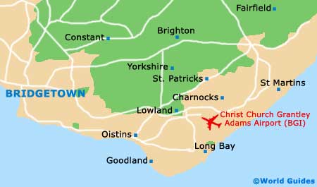
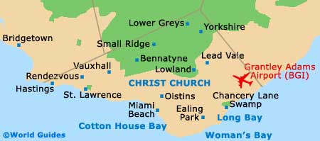
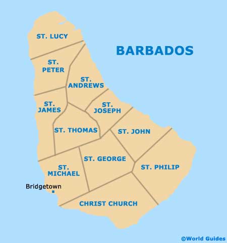
Christ Church is located on the south coast of
Barbados. It's fronted by turbulent Atlantic waters that make it better for surfing than swimming, so the resorts don't do as much developing in this area. Instead, the district of St. Lawrence Gap leads Christ Church with a heady selection of privately owned restaurants and bars. The atmosphere is especially rewarding for independent travellers.
West of Christ Church is St. Michael Parish, which hosts the capital city,
Bridgetown - only a 15-minute drive from St. Lawrence Gap and with a more complete set of commercial offerings. You won't find quite the spread of entertainment in Bridgetown, but you will find more in the way of duty-free shopping and transportation infrastructure. Those staying in Christ Church typically hire a car for the duration of their stay. Maps of the island are especially handy in this case.
Maps and Orientation of the Parish
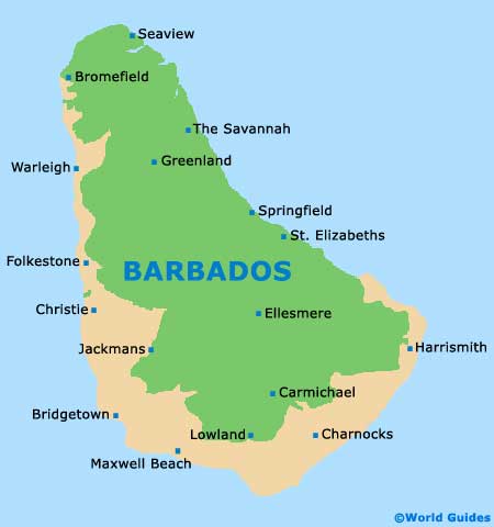
A map of Barbados is available from hotels, petrol stations and shops across Christ Church. Any number of places in St. Lawrence Gap have detailed maps on hand. You'll want to have a map if you're heading to the interior of the island to see Harrison's Cave or Flower Forest, and, even for a quick jaunt over to Bridgetown, since the network of minor roads criss-crossing the island can be a little confusing.
The best way to get a map is by picking one up from the company that arranges your hire car. They'll probably automatically include this with the car, but it's a good idea to make sure before driving off. Armed with a car and a map, you can cross the length of the island in less than an hour.
- Bath Beach - 25 km / 15 miles (35 minutes, north-east)
- Bathsheba - 21 km / 15 miles (28 minutes, north-east)
- Bridgetown - 8 km / 5 miles (12 minutes, west)
- Harrison Cave - 17 km / 11 miles (25 minutes, north-east)
- Holetown - 18 km / 11 miles (25 minutes, north)
- Speightstown - 27 km / 17 miles (35 minutes, north)
Map of Barbados
Map of Parishes
Map of Christ Church